Description
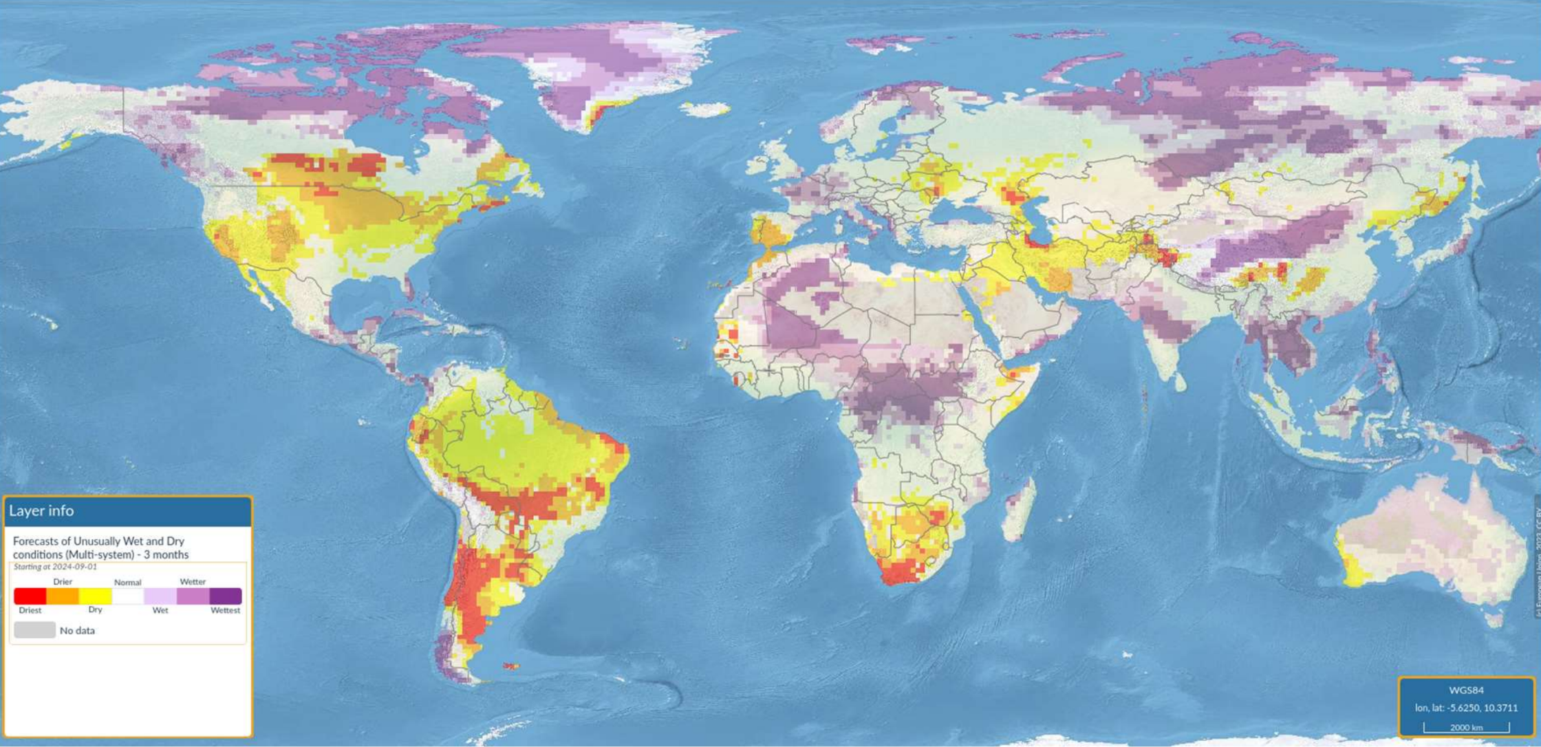
This is a dynamic monthly dataset that provides forecasts of anomalous wet and dry conditions across the globe for 1, 3 and 6 month aggregation periods.
Technical Description
This STAC Collection contains the European Drought Observatory (EDO) Wet/Dry Condition Forecasts v2.0.0 dataset, developed by the European Commission's Joint Research Centre (JRC). The dataset provides monthly forecasts of an indicator for wet and dry conditions across the globe. The indicator, which is computed based on forecasted Standardized Precipitation Index (SPI) values derived from each one of the single long-range (i.e. seasonal) forecast systems part of the Copernicus Climate Change Service (C3S), is used to highlight those regions where unusually wet or dry periods are forecasted for the next 1, 3, or 6 months
The Indicator for Forecasting Unusually Wet and Dry Conditions provides early warnings of persistent unusually wet and dry precipitation conditions globally. The indicator, the technical details of which are fully described by Lavaysse et al. (2020), is computed from forecasted Standardized Precipitation Index (SPI) values for 1-month, 3-month, and 6-month accumulation periods (i.e. SPI-1, SPI-3 and SPI-6). The SPI forecasts are derived from forecasted precipitation provided by the latest probabilistic (ensemble) seasonal forecasts of C3S. The indicator provides early warnings of unusual precipitation periods only when and where the forecast is considered robust (i.e. with at least 40% of ensemble members associated with forecasts exceeding calibrated climatological thresholds) corresponding with significant SPI values. Different wet/dry condition levels depend on both the severity and the level of significance of the forecast, and according to the 24-year reference (or “re-forecast”) period (i.e. 1993-2016).
Below is the classification of the wet/dry condition levels:
- 0: Normal conditions (not unusually wet or dry)
- 1: An unusual wet or dry event is forecasted, with large model reliability and / or forecast intensity. This forecast has a 6-year return period or larger (based on the 24-year re-forecast period).
- 2: An unusual wet or dry event is forecasted, with a continued increase in model reliability and a larger forecast intensity. This forecast has a 12-year return period or larger (based on the 24-year re-forecast period).
- 3: Maximum level of alert. An unusual wet or dry event is forecasted, with both model reliability and forecast intensity at their maximum. This forecast has a 24-year return period or larger (based on the 24- year re-forecast period).
This collection contains the multi-system ensemble wet/dry forecast indicator.